Comprehensive Land Development & Geospatial Services
Integrated surveying, civil engineering, environmental compliance, and precision installation—designed to save you time and money.
-
Surveying: The core service at Precision Geospatial Solutions, LLC, underpinning all other offerings.
Topographic Mapping: Creates detailed elevation and contour maps representing natural and built features for planning and construction.
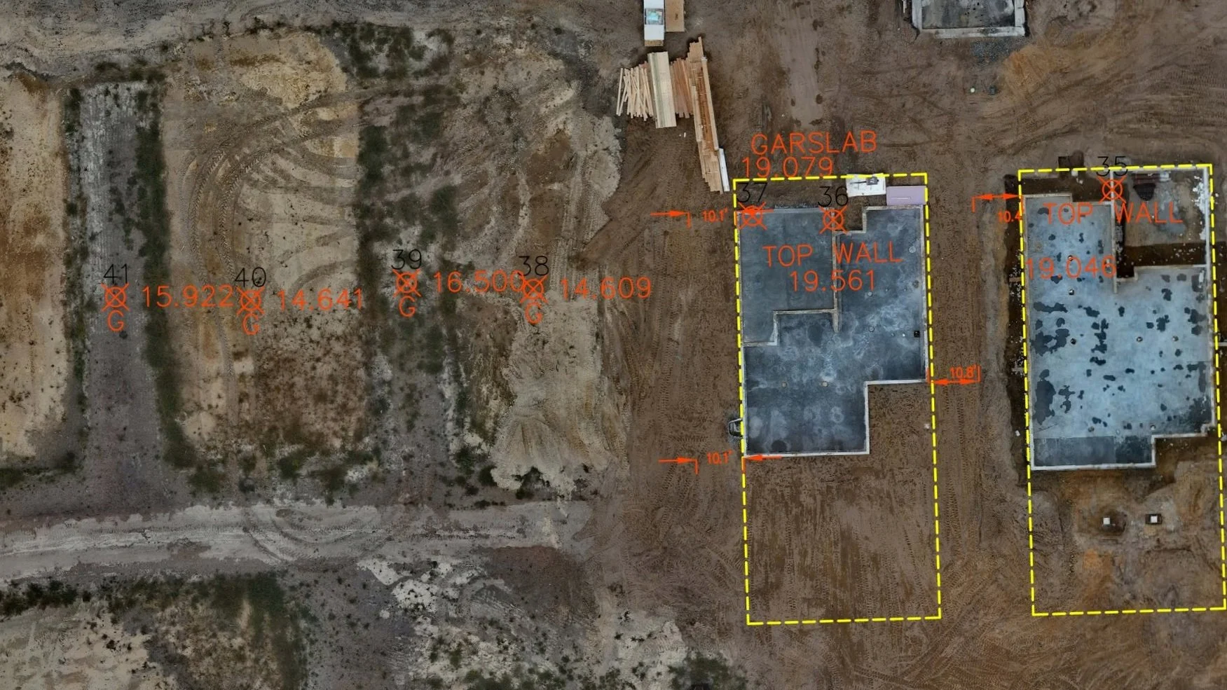
Construction Staking & Layout: Ensures design compliance using precise measurements to reduce errors and delays.
Survey Reports & Documentation: Provides clear, detailed reports and digital maps to support planning, legal, and construction decisions.
Construction Stakeout
-
Land Development Engineering Services
Environmental Compliance & Permitting
Chapter 102 NPDES Permits Complete erosion and sediment control planning and permitting services for earth disturbance activities. We handle all aspects of NPDES permit applications, from initial site assessment through permit acquisition and compliance monitoring.
Chapter 105 Waterway Encroachment Permits Comprehensive waterway encroachment permitting services for projects affecting streams, wetlands, and floodplains. Our team manages the entire permit process including environmental assessments, mitigation planning, and regulatory coordination.
Stormwater Management Solutions
Stormwater BMP Design Custom design of Best Management Practices (BMPs) to meet regulatory requirements and site-specific conditions. Our solutions include detention basins, infiltration systems, green infrastructure, and innovative stormwater management technologies.
Stormwater System Design Complete stormwater conveyance and management system design including pipe networks, culverts, channels, and outlet structures. We ensure compliance with local and state regulations while optimizing system performance and cost-effectiveness.
Additional Land Development Services
Site Plan Development Comprehensive site planning and design services including grading plans, utility layouts, access design, and regulatory compliance documentation.
Hydrologic & Hydraulic Analysis Detailed watershed analysis, flood studies, and hydraulic modeling to support design decisions and regulatory submittals.
Construction Documentation Complete construction drawing packages, specifications, and project management support to ensure successful project implementation.
Structural Design of Retaining Walls
-
On-lot Septic Testing/Permitting & Design
Our experts conduct thorough on-lot septic system evaluations, ensuring compliance with the latest state regulations. We provide permitting services that streamline the process for both residential and commercial projects, ensuring timely and effective solutions.
Act 537 Sewage Facilities Planning Modules
We specialize in the preparation of Act 537 planning modules, which are essential for the development and approval of sewage facilities. Our team is experienced in assessing existing systems, exploring innovative solutions, and securing necessary permits to meet regulatory requirements.
Stormwater Hydraulic Conductivity Testing
To support effective stormwater management, we perform hydraulic conductivity testing (Ksat) that is crucial for the design and implementation of Best Management Practices (BMP). Our testing ensures that stormwater facilities are designed to function effectively, providing long-term environmental protection.
Wetland Delineation per USACE Manual 1987
Our services also include wetland delineation following the USACE Manual (1987). We conduct site assessments to identify and delineate wetland boundaries, providing critical information for project planning, permitting, and compliance with environmental regulations. This ensures that all developments are conducted in a manner sensitive to the ecological significance of wetland areas.
-
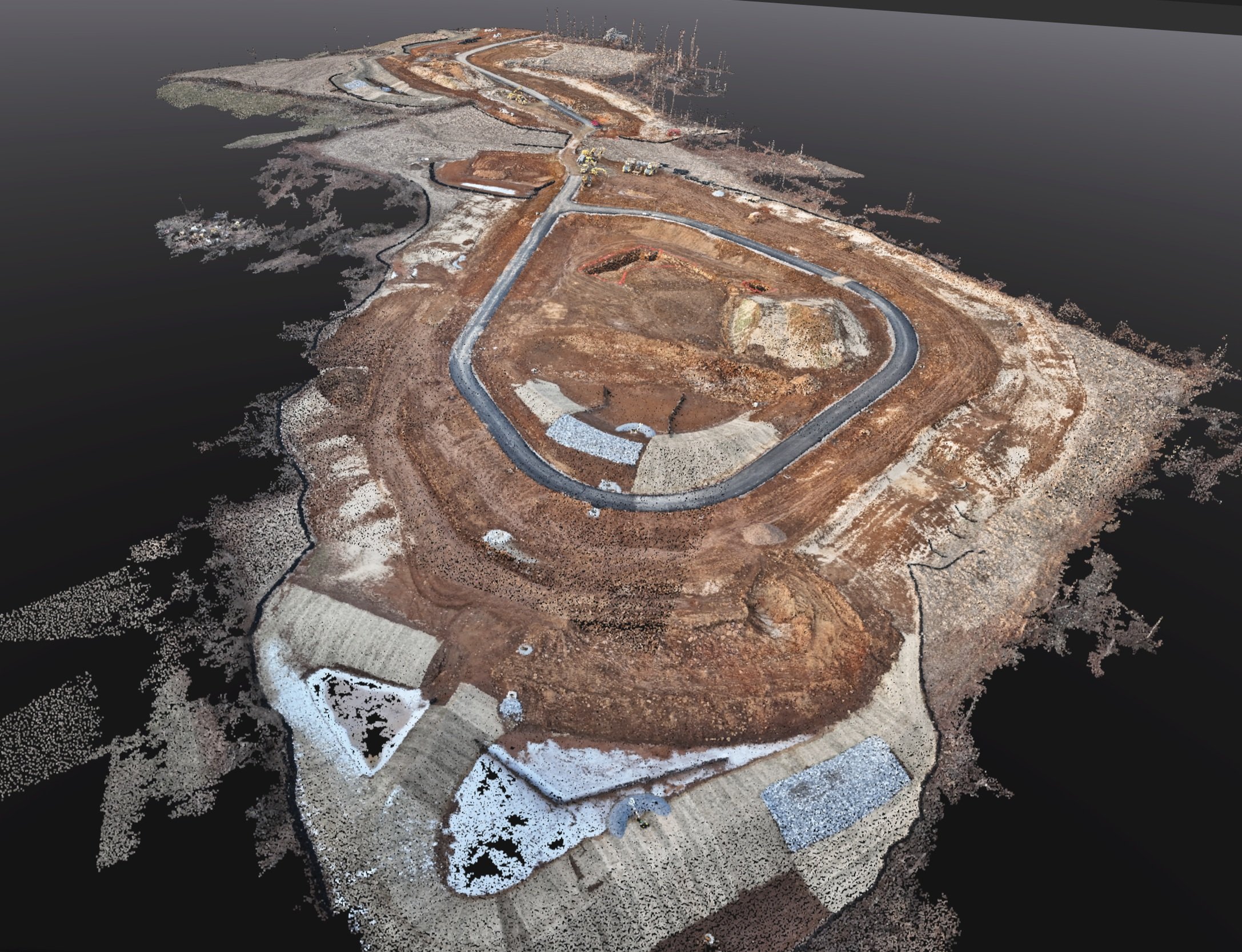
High-Resolution Land Surveying: Leverage aerial drones to capture detailed imagery and 3D terrain data, ensuring precise site measurements and accurate boundary mapping.
Accurate Volumetric Analysis: Use advanced imaging and photogrammetry to calculate stockpile volumes, excavation quantities, and earthworks with confidence and efficiency.
Comprehensive Land Planning Support: Provide expansive aerial surveys that underpin strategic site analyses, inform infrastructure layouts, and optimize development proposals.
Infrastructure & Asset Inspection: Employ drones for routine inspections—monitoring roads, utilities, and construction progress—thus reducing risks and downtime.
Rapid Data Acquisition Across Challenging Terrains: Access hard-to-reach areas quickly and safely, delivering timely data for urgent project evaluations and decision-making.
Enhanced Imaging Capabilities: Integrate multispectral, thermal, or LIDAR imaging techniques to offer specialized insights for environmental assessments and asset management.
Customized Aerial Solutions: Adapt drone services to meet the unique demands of every project, ensuring flexibility and precision in every capture and analysis.
-
Smart Design. Efficient Execution. Maximum Value.
US-PGS delivers comprehensive earthwork and site contracting design that optimizes your project from day one. Our integrated approach combines advanced surveying technology, precise engineering, and real-world construction expertise to create designs that work seamlessly in the field.
What Sets Us Apart:
Constructability-Focused Design - We design with dirt-moving efficiency in mind, reducing costs and accelerating schedules
Cut/Fill Optimization - Advanced modeling techniques that minimize material hauling and maximize on-site balance
Machine Control Ready - All designs optimized for modern GPS-guided earthmoving equipment
Our Process Delivers Results: From initial site analysis through final grading plans, we provide the technical foundation that turns complex earthwork challenges into streamlined construction success. Every design decision is made with your bottom line and project timeline in mind.
-
US-PGS offers a unique advantage in the industry - we install what we design. From septic systems and stormwater management to precision excavating and grading, our integrated approach eliminates costly miscommunications and ensures flawless project execution.
Our Installation Services:
Septic System Installation - Complete on-site wastewater treatment system installation with proper sizing, placement, and regulatory compliance
Stormwater System Construction - Installation of detention basins, infiltration systems, pipe networks, and BMP structures exactly as engineered
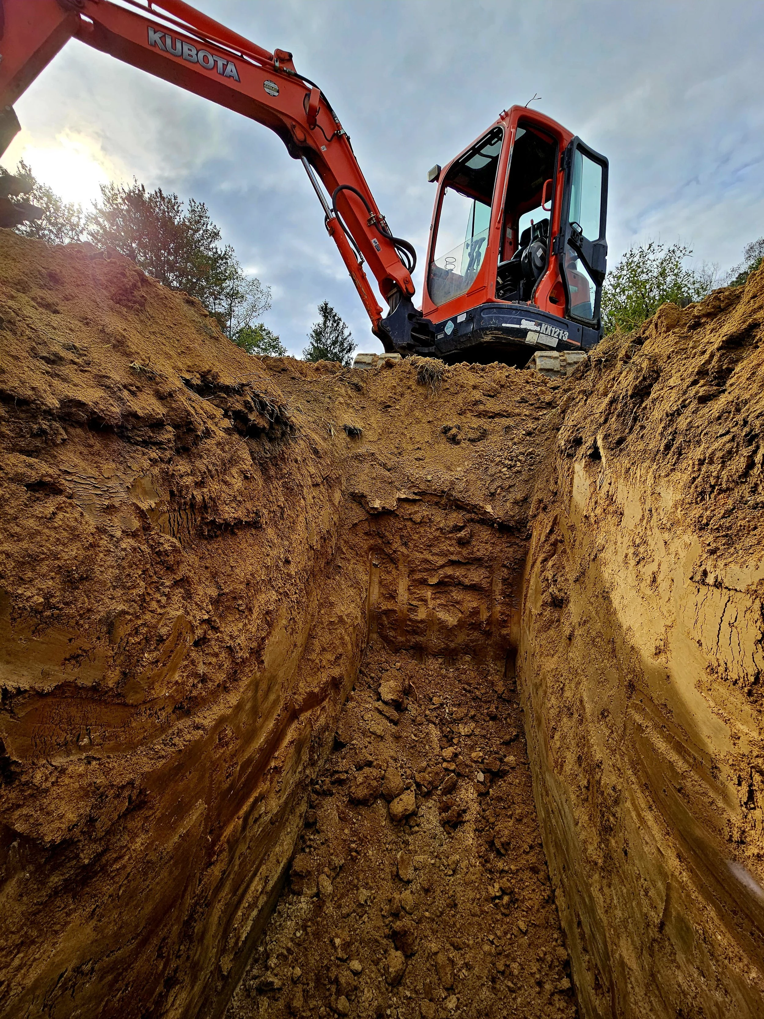
Precision Excavating & Grading - GPS-controlled earthwork that delivers design grades with millimeter accuracy